

35% check dams broken, 32% percolation tanks encroached in drought-prone Yavatmal district of Maharashtra: Study
A field-based study shows how poorly built and ill-maintained water harvesting structures in Yavatmal district of Vidarbha are failing to capture rainwater and thus not contributing towards groundwater recharge. This needs to be fixed, the report recommends.

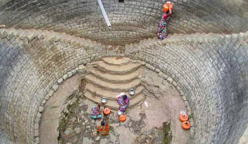
A large area of Maharashtra is prone to recurring droughts, including Yavatmal in Vidarbha. Pic: Nidhi Jamwal
The southwest monsoon is in an active phase across the country with most regions receiving good rainfall. It is the monsoon rainfall which not only sustains farming but also replenishes the groundwater. However, mismanagement of rainfall often leads to water stress and recurring drought, and Vidarbha region in Maharashtra is infamous for it.
Now a recent field-based study shows how poorly built and ill-maintained water harvesting structures in Yavatmal district of Vidarbha are failing to capture the rainwater and thus not contributing towards groundwater recharge.
A total of 686 structures comprising check dams, percolation tanks, ponds, water storage tanks, and reservoirs were mapped across the district by the Institute for Sustainable Communities (ISC), a global non-profit organisation. The mapping exercise found more than 35 per cent check dams were broken and another 32 per cent percolation dams were either damaged or encroached.
Water security in Yavatmal district could be at risk if steps are not taken to revive and renovate water harvesting and recharge structures, points out the institute’s report — Water Harvesting and Recharge Structures in Yavatmal District: A Status Check — released today July 20 in Mumbai.
“The analysis and findings will help prioritise the revival efforts of the various water harvesting and storage structures in Yavatmal. It will help decision-makers plan for augmenting water resources in the district,” said Vivek P Adhia, Country Director-India, Institute for Sustainable Communities, while emphasising the need for community participation and creating mechanisms for effective operation and maintenance.
Yavatmal in Vidarbha
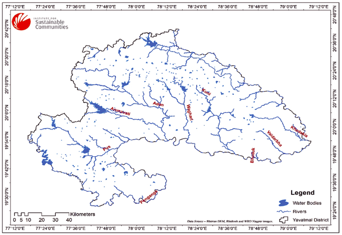
Yavatmal in Vidarbha region of Maharashtra, which is also known as the farmers’ suicide capital of India, receives an annual rainfall of 880 millimetre (mm) to 1,150 mm. It has has two main rivers namely, Painganga and Wardha. Both the rivers have various tributaries. Tributaries of Wardha river include Adan, Nirguda, Pus, Kupti, Waghadi, Juni.
Although the district spreads over an area of 1,352,000 hectares. However, the cultivable area is about 884,000 hectares. Cotton is the most important crop of the district grown in an area of 405,000 hectares. It is largely grown during the kharif season. Soybean cultivated on 287,000 hectares is another important kharif crop.
Also Read: Maharashtra’s food output to fall sharply as a result of climate change post 2033: Study
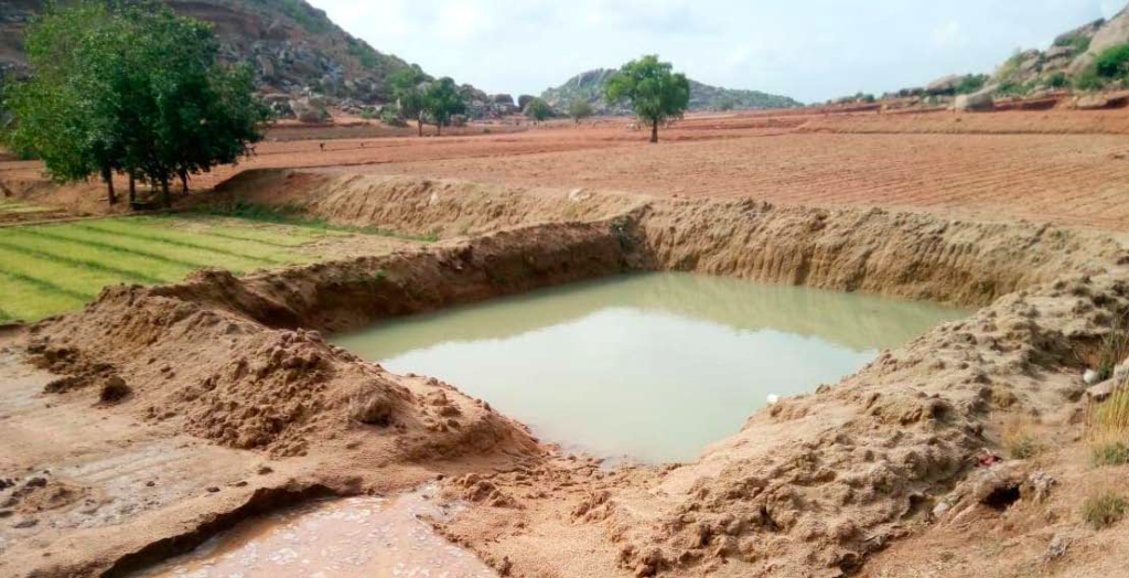
The district has seen the construction of different types of water harvesting, water storage and water recharge structures (KTW – Kolhapuri Type Wear, CNB – Cement Nala Bund, check dam, percolation tanks, water storage tanks, farm ponds, dohas) across different government programmes and by private agencies and foundations. These structures have majorly been constructed to recharge groundwater and to store water for irrigation and domestic purposes.
The recent report of the Institute for Sustainable Communities notes that 78.4 per cent of the districts domestic and agriculture water requirement is met from groundwater sources, and the remaining 21.6 per cent is met by surface water sources. This clearly shows the important of harvesting rainwater and recharging the groundwater.
Mapping water harvesting structures
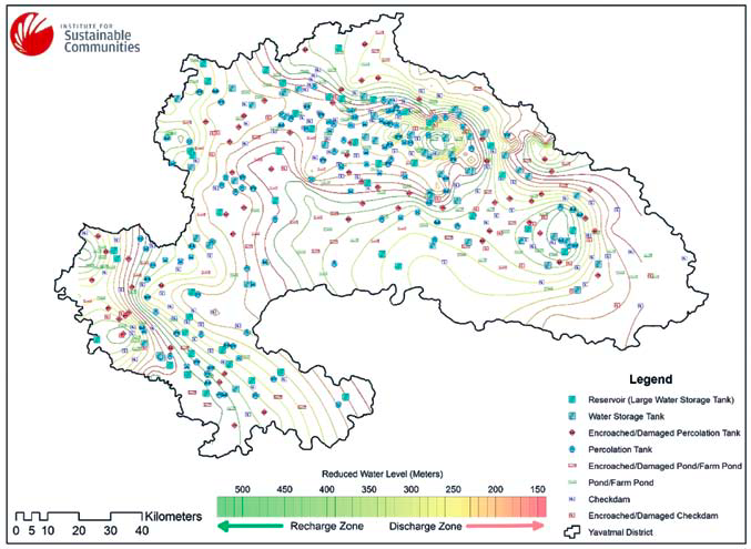
As part of its study to map the water harvesting structures in Yavatmal district, the Institute for Sustainable Communities obtained satellite images with 30 meters resolution from Bhuvan, which is an Indian web based utility that allows users to explore a set of map based content prepared by Indian Space Research Organisation (ISRO).
Data on existing water bodies was downloaded from Bhuvan and the location and boundary data were merged with the primarily collected boundary of the structures to map the exact location of the existing structures. The identification of the water accumulation zone and water recharge zone was done on the basis of borewell data collected from the different government and private agencies. In addition, primary data on the dug wells was collected from various field locations in Yavatmal. Ground truthing validated the mapping results with the status on ground.
Broken, damaged and encroached structures
A total of 686 structures comprising check dams, percolation tanks, ponds, water storage tanks, and reservoirs were mapped across the district. These included 204 check dams, 211 percolation tanks, 175 farm ponds, 52 water storage tank and 44 reservoirs.
“Around 73 check dams were found to be damaged or encroached. Of the 73 check dams, that are either encroached or damaged, 28 lie in recharge zones which should be prioritised for revival,” points out the mapping report.
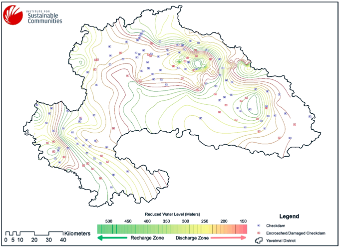
Further, of the total 211 percolation tanks mapped, “around 68 percolation tanks were found to be damaged or encroached. Of the 68 percolation tanks, that are either encroached or damaged, 47 lie in recharge zones which should be prioritised for revival. Rejuvenation of percolation tanks will help in recharging aquifers in the region,” reads the report.
Also Read: ‘232 Indians killed in water conflicts between 2017 and 2019’
Similarly, of the 175 farm ponds mapped, 57 were found to be damaged or encroached.
However, of the 52 water storage tanks mapped, only two structures were found to be encroached.
Also, of the 44 reservoirs mapped, the study found that 34 have been “suitable constructed in discharge zones while none of them show any encroachment or damaged”.
Maintaining water harvesting structures with community support
Situation is worrisome in Yavatmal because the rate of groundwater decline in the district has been around four metres, as the recent report notes. “more than 35% of the check dams and 32% of the percolation tanks are either damaged or have been encroached. Communities have pointed towards the poor operation and maintenance of the structures as a major reason for the current state,” it reads.
Also Read: Centre’s recent agrarian market reforms may lead to mismanagement of water resources
The Institute for Sustainable Communities recommends that a comprehensive plan for repair, renovation and reconstruction of the water harvesting and recharge structures are carried out in the district to ensure long term availability and sustainability of water resources. This should include a plan to ensure their maintenance involving the engagement of the gram panchayat and the village communities, the report stresses.