

Half of Assam’s districts flood-affected; CM urges people to avoid NH 715 due to displacement of animals in Kaziranga
Nearly 260,000 people across 16 districts of Assam are affected by floods while Lakhimpur is the worst affected district. A total of 732 villages across these 16 districts are inundated. River Brahmaputra in Dhubri, Goalpara, Sonitpur districts, continues to flow above ‘danger level' and is forecasted to rise further.

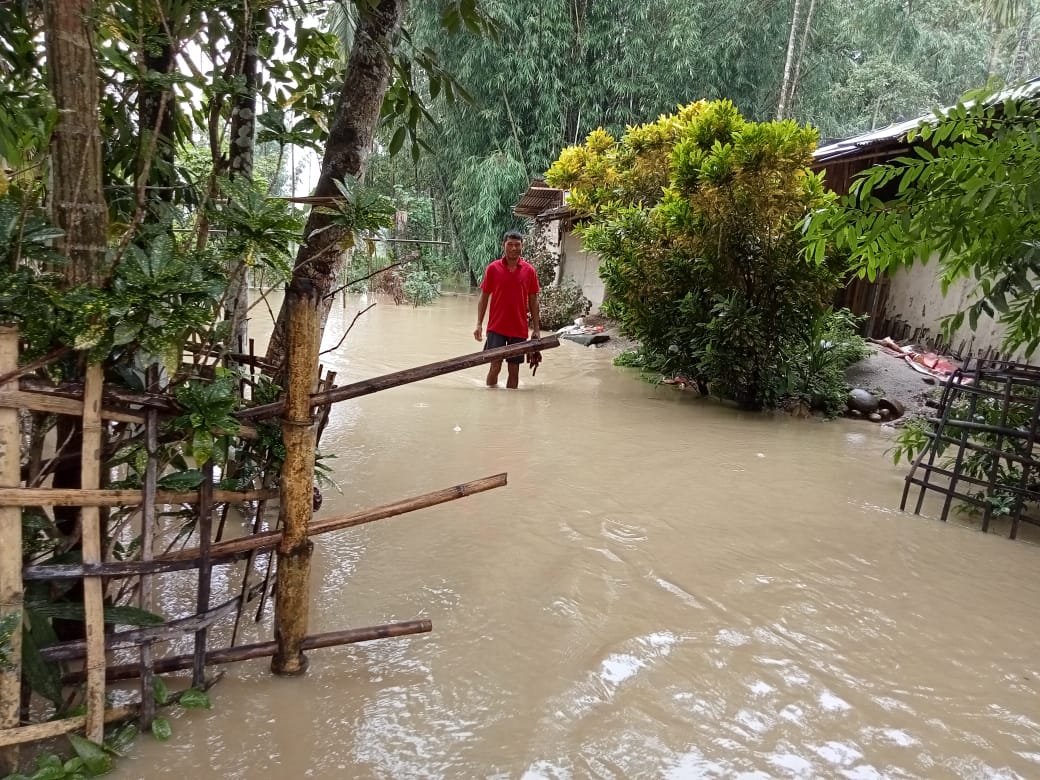
Floods in Dhemaji district of the state. Pic: India Red Cross Society Assam State Branch/twitter
The flood situation in Assam deteriorated yesterday on August 29 as a total of 258,191 people across 16 districts of the state have been affected by the disaster. Nearly half (48.5 per cent) of the state’s area is inundated and of the total 33 districts in Assam, 16 are flood-affected. These include Barpeta, Biswanath, Bongaigaon, Chirang, Dhemaji, Dibrugarh.
According to the daily flood report of the Assam State Disaster Management Authority (ASDMA), a total of 732 villages across these 16 districts are inundated, with the highest number of flood-hit villages in Lakhimpur (131 villages) where 105,257 people including women and children are affected. The floods have damaged at least 24704.86 hectares of crop areas across the 16 affected districts in the northeastern state.
As per the latest reports, State Disaster Response Force (SDRF) and National Disaster Response Force (NDRF) and other rescue teams evacuated 50 people and 450 animals in Dhemaji by boat yesterday. The state government has set up 24 relief camps in Bongaigaon, Chirang, Dhemaji, Dibrugarh, Golaghat, Jorhat, Lakhimpur, Majuli, Sivasagar, and Tinsukia.
Impact on animals
Besides humans, a total of 239,723 animals are estimated to have been affected. These include 12,591 poultry, 196,693 big and 30,439 small animals.
Nearly 60 per cent of the total 430 square km area of Kaziranga National Park is reportedly submerged by floodwaters. A large number of wild animals have come out from the national park in search of highlands on the southern boundary of the park. While crossing the highway to reach nearby Karbi hills in the southern boundary, two hog deer were killed yesterday on national highway 37.
Assam Chief Minister Himanta Biswa Sarma today on August 30 urged vehicles to be avoided on NH 715 for commuting between lower and upper Assam due to displacement of Kaziranga animals amid floods.
The Central Water Commission Official Flood Forecast has warned that River Subansiri at Badatighat in Lakhimpur district is flowing at the ‘danger level’ at a water level of 82.53 metres.
River Brahmaputra in Dhubri district, Goalpara district and Guwahati of Kamrup district, Tezpur of Sonitpur district, continues to flow at ‘danger level’ and is forecasted to rise further.
Flood hazard in Assam
Assam is one of the most flood-prone states of the country. “Although occurrence of flood has been an age-old phenomenon in the riverine areas of this region, the extent of damage caused by the flood has increased significantly in recent years. With more than 40 percent of its land surface susceptible to flood damage, the total flood-prone area in the Brahmaputra valley is about 3.2 Mha (million hectares),” notes the website of Assam State Disaster Management Authority.
Map: Flood hazard map of Assam (Different colours represent different hazard classes)
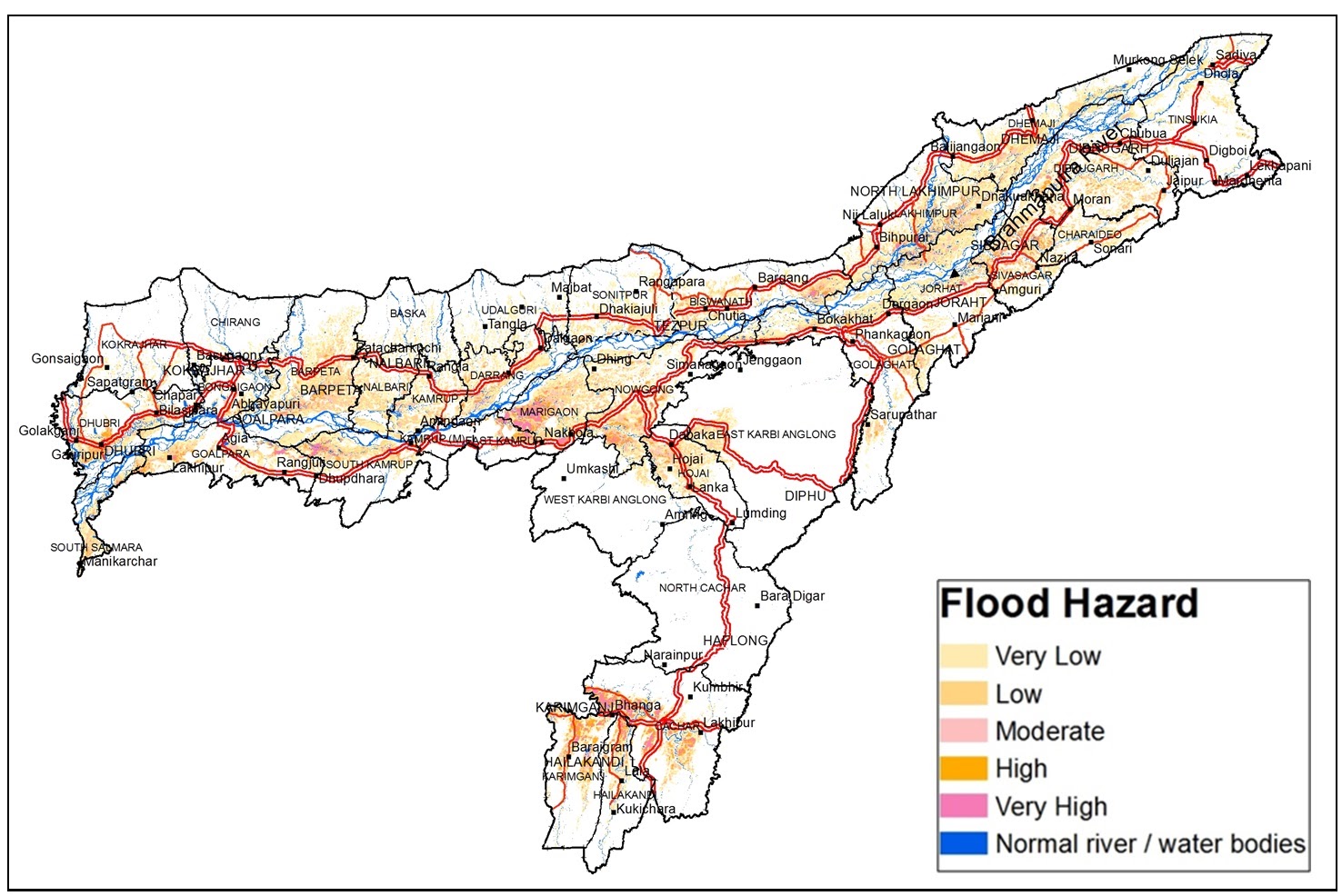
In 2016, the state government, along with ISRO, prepared a Flood Hazard Atlas for Assam which classifies flood-prone areas in the state in five broad categories (very low, low, moderate, high, and very high) based on flood hazard.
‘Very low’ category areas include districts that have faced floods one to two times floods between 1998 and 2007, whereas ‘very high’ category includes areas that face floods almost every year.