

Is North Bihar prepared for the overlapping challenge of COVID-19 and the annual floods?
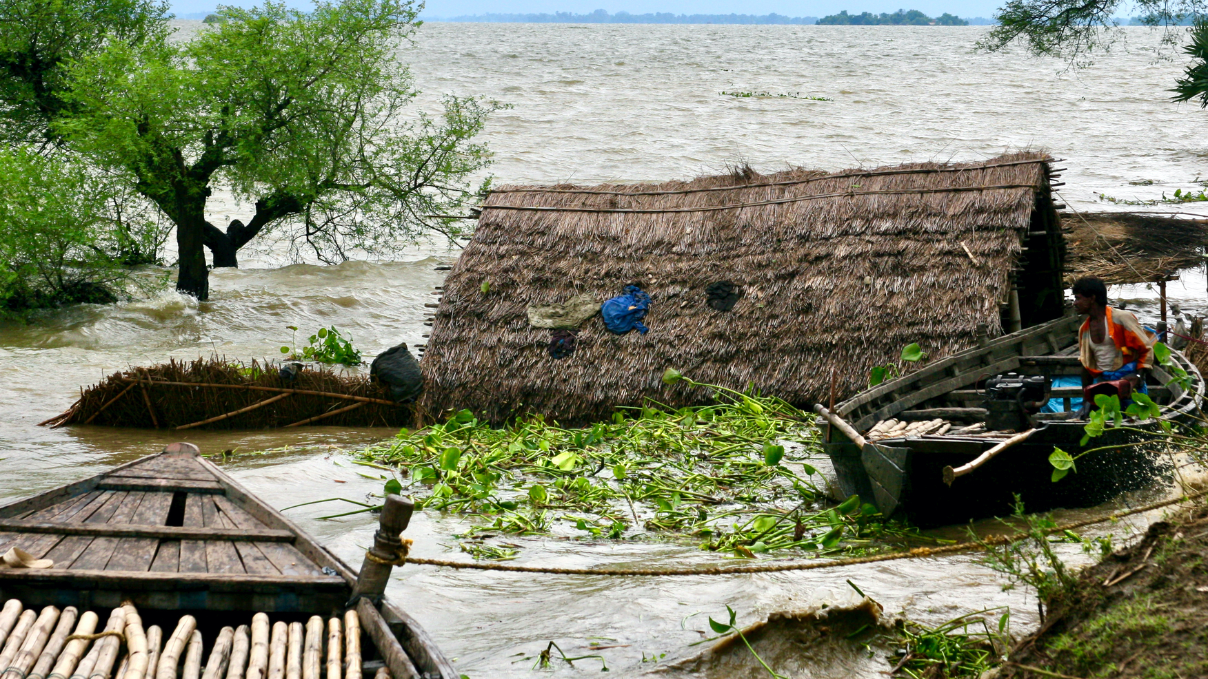
North Bihar, the most flood-prone area in the country, is notorious for floods that happen almost every year. But, this year, it may be a double whammy as floods will have to be managed amid the ongoing coronavirus disease pandemic. There is a need to develop mechanisms to lessen the flood vulnerabilities by focusing on the first two phases of the floods — pre-floods and during the floods


Photo: WaterVagabond
Eklavya Prasad and Nirmalya Choudhury
Last month, in April, the South Asian Seasonal Climate Outlook Forum (SASCOF), a consortium of meteorologists and hydrological experts from South Asian countries, including Afghanistan, Pakistan, India, Nepal, Bangladesh, Sri Lanka, Bhutan, and Myanmar, stated that the southwest monsoon of 2020 will be normal for the whole of South Asia. The forecast by the SASCOF should be a caution for Bihar for two reasons. First, it receives more than 85 per cent of its annual rainfall during this active monsoon period, which extends from June till September. Second, the flow in (North) Bihar’s small and big trans-boundary rivers is also determined by the precipitation in Nepal. A normal monsoon often results in flooding in Bihar which is the most calamitous disaster that occurs almost annually in the state displacing millions of people and causing huge damages.
Therefore, it is time the state and the non-state actors start work on strategic preparedness and planned response towards addressing the vulnerabilities of habitations that will be exposed to the threat, occurrence, and aftermath of floods. However, this year, the approach has to be strategised differently and executed in an unprecedented manner owing to the presence of the coronavirus disease (COVID19) pandemic, and with the return of the guest workers (a respectable expression to address the migrant workers) to the safe haven, their home.
As the southwest monsoon is approaching, the status of COVID19 is changing fast in Bihar. As of May 26, all the 38 districts of Bihar have novel coronavirus positive cases. A total of 63,741 people has been tested, of which 2,870 cases are confirmed. Close to 74 per cent of the confirmed cases are active, approximately 25.5 per cent has recovered, and 0.45 per cent of total cases have died.
As of May 26, the districts with maximum reported and active cases in the state are Patna, Begusarai, and Madhubani, and all these three districts are in a flood-prone zone, vulnerable to different flooding patters — urban flooding, flash, and riverine floods. Planning and execution of flood response, in sync with the corona containment norms, will be a new test for the state and non-state actors. In addition, the returning of guest workers to the flood-prone districts of Bihar from across the country, after having gone through hell to reach heavens, will add another dimension of psychosocial care to the existing maze of flood preparation and response.
According to a recent media report, half a million guest workers have already arrived in Bihar. Another 0.82 million are scheduled to arrive soon, taking the number of guest workers in the state to 1.35 million. It is also been estimated that the return of 1.35 million guest workers, the state is set to add 1.25 per cent to its population. Response to the different patterns of flooding, adhering to the containment norms, with a dynamic population marred by unprecedented social and economic footprints of COVID-19, is going to be a big challenge.
North Bihar: Highly dense and highly flood-prone
Bihar’s population, along with health inequalities, economic and social disparities, presents unique challenges. The situation is slightly more vulnerable in North Bihar, because of the approximated population density, the corona pandemic, and the vulnerability to floods leading to its multiple consequences in the new normal.
North Bihar has an approximated population density of 1,294 persons per sq. km with an estimated 65.54 million population (as against 103.80 million of the entire state). The population density of North Bihar, if compared to Rajasthan, which is at 200 persons per square kilometre, projects the denseness of the regional population, which is almost six times of the Rajasthan state.
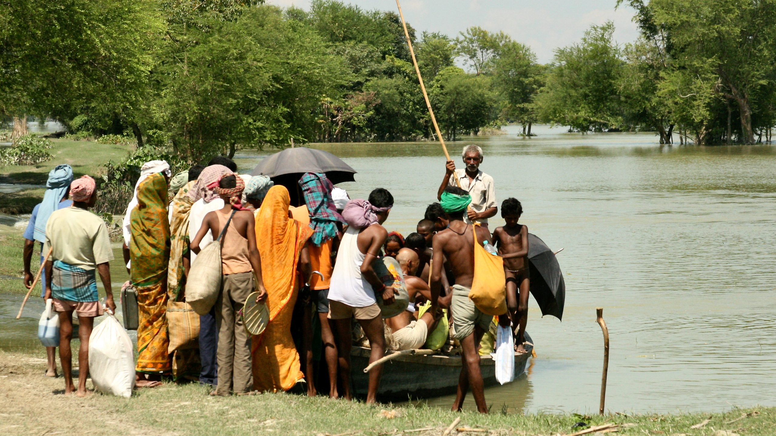
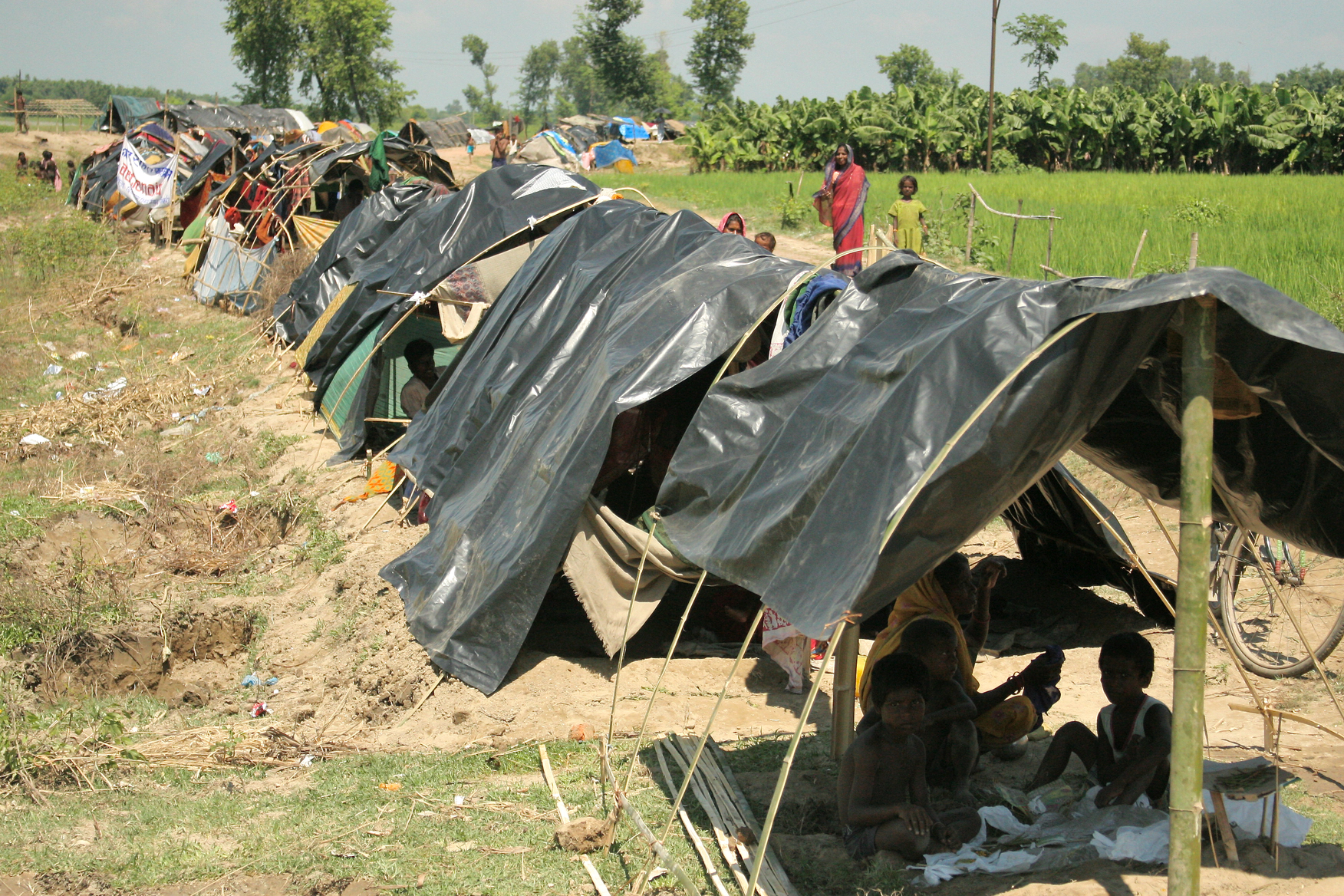
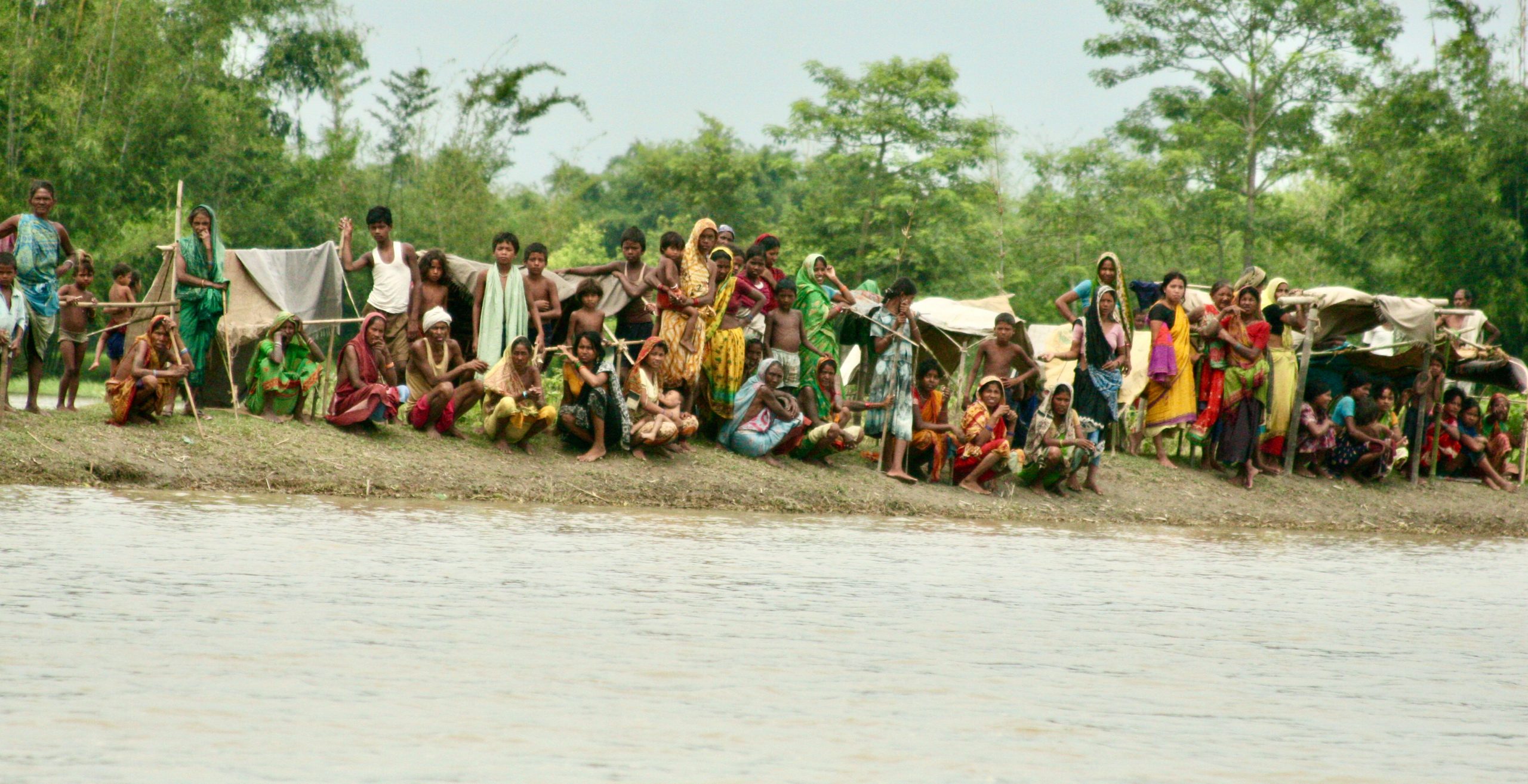
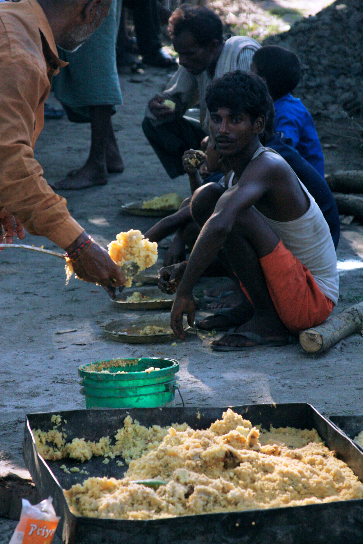
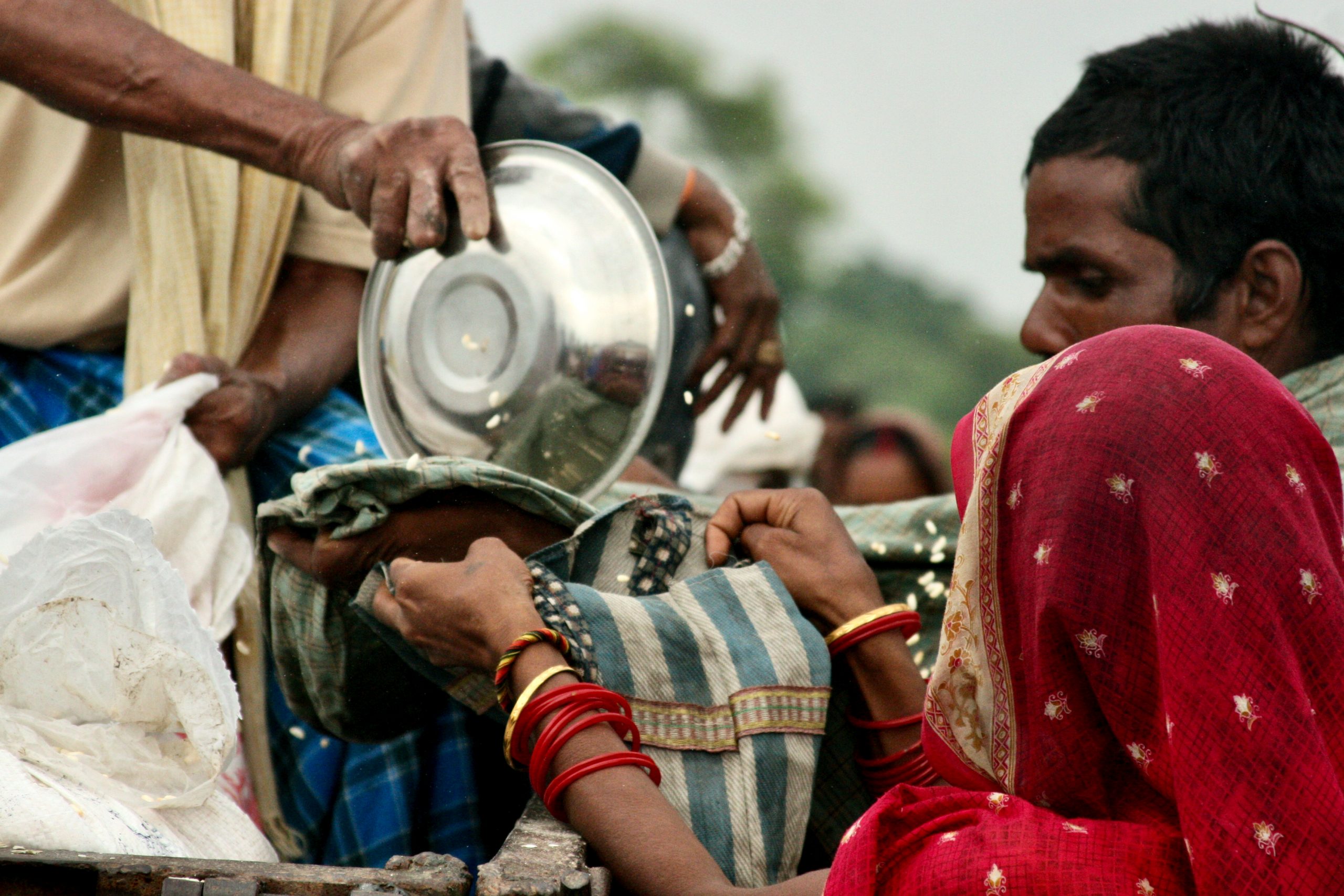
Floods, a recurring problem from June till October for the northern part of the state will soon usher in a new set of challenges. In normal circumstances, apart from the strengthening of embankments, no other pre-emptive strategies to withstand the likelihood of floods in this region are taken up. Densely-populated habitations; contextual safe water supply and sanitation facilities, multi-layered social inequities, and the homecoming of the guest workers, all together are going to pose a situation that none have encountered earlier. This is the ecosystem in which the rural population will be living during floods. Therefore, this year North Bihar inevitably will be exposed to either contiguous or overlapping challenges of corona pandemic and floods.
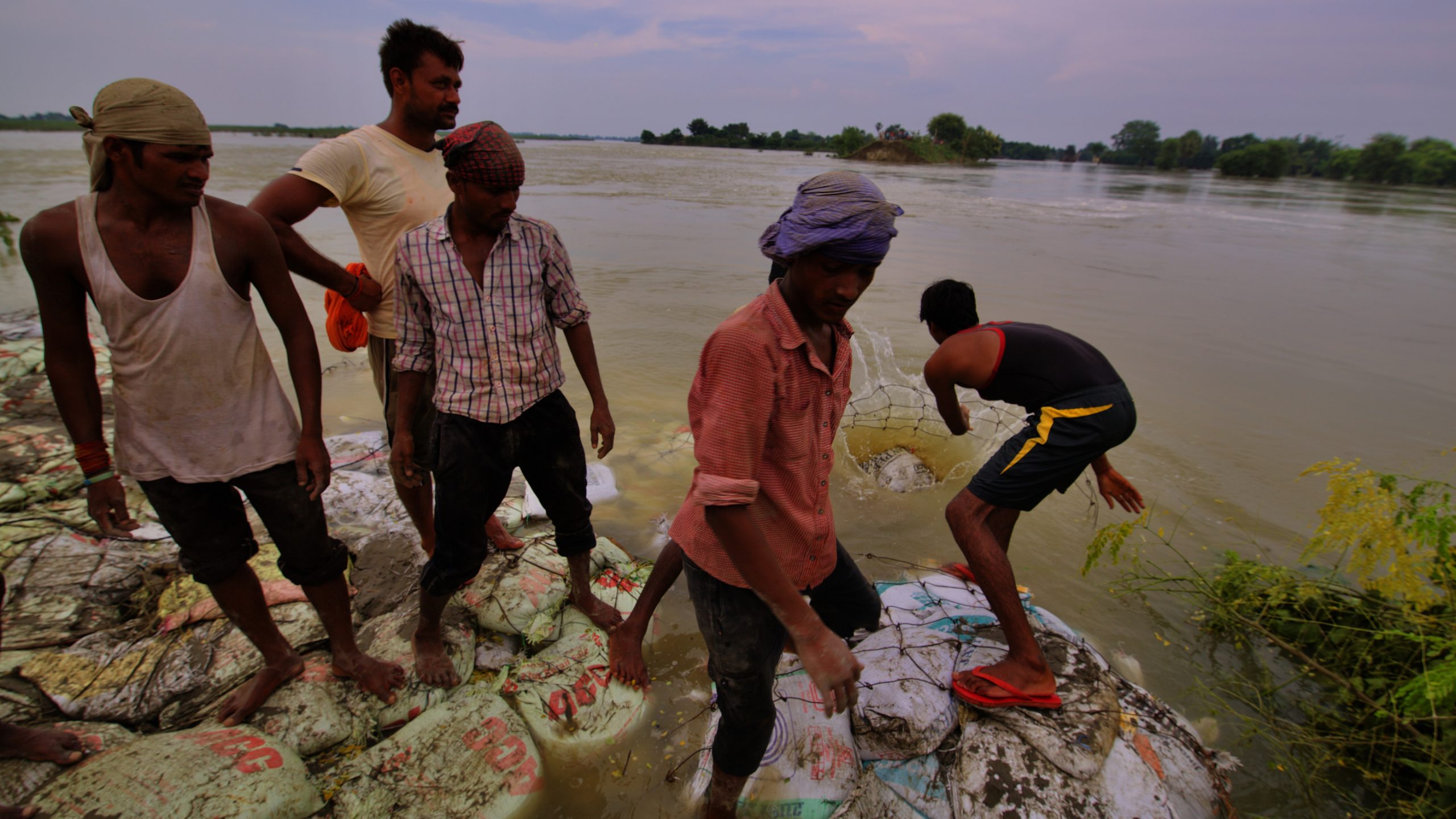
North Bihar and floods are synonymous, which can be easily substantiated through figures of the affected population during major flood occurrences. In 2017, 17.1 million people were affected; in 2015, three million were affected; in 2013, 20 districts were affected impacting the lives of 7.23 millions; in 2010, 0.718 million people were affected; in 2008, a total of 3.3 million population was affected. In 2007, floods devastated 25 million people; in 2004 it created havoc in the lives of 21 million people; in 1987, it affected 28.2 million population; in 1974, it disrupted the lives of 16.39 million people.
According to the Bihar State Disaster Management Authority (BSDMA), between 2008 and 2016, a total of 629 blocks and 27.38 million people were affected by floods, and the total area of agriculture land affected was 11.19 million hectare (mha), which is slightly more than thrice the total flood-protected area in North Bihar.
North Bihar’s land is dotted with embankments, and they remain a critical point of reference for people while stating the location of their habitation as inside or outside the embankment. As per the general understanding, habitations located in the countryside (not on the flow of the river) are considered outside the embankment and the ones located in the riverside (on the flow of the river and between the embankments) are considered inside the embankment. However, the inhabitants that are in the riverside think otherwise.
According to them, riverside is a perpetual flood-affected area, experiencing floods on an annual basis, hence they do not consider themselves protected from floods, therefore they believe that they are outside the embankment. And because the habitations in the countryside are protected by the embankments and are relatively flood-free, therefore they are inside the embankment, according to the inhabitants that are in the riverside.
This differing perception of who is inside and who is outside the embankment from the vantage point of the inhabitants clearly indicates the local interpretation of being protected and under threat from floods and getting exposed to the uncertainties, and therefore needs to be made the core of all discourses and initiatives. Therefore, it is of utmost importance that this local comprehension of the landscape is considered while dealing with the containment of COVID-19 in the flood-prone regions of North Bihar.
Floodscapes in North Bihar
Eighteen districts of North Bihar are prone to recurring floods with multi-layered inequities involving social, cultural, and economic dimensions. Megh Pyne Abhiyan (MPA), a Delhi-based public charitable trust, working on issues leading to water distress in the East Indian states (Bihar, West Bengal, and Jharkhand) concerning groundwater, drinking water, sanitation management. While working in the Bihar since 2005, it has identified the following diverse habited floodscape (also referred to as typologies) across North Bihar,
- Waterlogged regions
- Riverside of the embankments (also referred to as areas within the embankments of the same river system)
- An area in the riverside which is adjacent to or surrounded by a perennial river and is subject to the alluvial action of that river
- Riverine floods in the embankment-less region
- Riverine floods in the countryside after the breach of the embankment
- Flash floods in the riverside of embankments
- Flash floods in regions without embankments
- Floods/Waterlogging/Inundation in regions, between embankments of two river system
Habitations in these eight diverse floodscapes or typologies across the seven river systems in North Bihar have their own commonalities and differences. Therefore, it is important to view the entire characteristics (unexceptionals and peculiars) of floods across its three phases — pre, during, and post, in consonance with the existing COVID-19 pandemic, and the return of the guest workers to charter the integration keeping in view the prescribed social etiquettes, safe practices, physical distancing, myth busters, etc for the containment of the pandemic.
The integration has to be further nuanced into strategies across the three phases of floods — prior, during and subsequent to floods. Therefore, the goal during the Southwest monsoon of 2020 must be to conceptualise, design and implement safeguard strategies beyond the rhetorics, beginning with the preparatory phase.
Strategies to manage floods and COVID19
The concern will be on developing mechanisms to lessen the flood vulnerabilities by focusing on the first two phases — prior to and during floods. In the beginning, emphasis should be on developing a ward level (the gram panchayat is divided into wards) plan through engagements with the residents for enhancing the preparedness. The plan should have strategies for overcoming the transformations that are flood-induced and enhance access to basic amenities, in sync with the norms for containment of the corona virus, with a specific focus on addressing vulnerabilities of the stressed groups — women, senior citizens, and adolescent girls
Following practices must be adopted and implemented together with the community during the first two phases of floods
Pre floods
- Ward/panchayat specific risk profiling of both the COVID-19 pandemic and of the different typologies of floods for developing specific interventions
- Mapping of spaces for the construction of elevated platforms that would act as flood shelters at the ward level through Mahatma Gandhi National Rural Employment Guarantee Act (MGNREGA) (with twin benefits: employment generation, and as a shelter, before the flood strikes)
- Mapping and demarcation of spaces for community kitchens at the ward and panchayat level for easy and safe access
- Identification of additional public places at the ward and panchayat level to be developed as a flood shelters with all amenities while adhering to the principle of physical distancing
- Periodic organised mock drills for the safe movement of the community members during floods spearheaded by the ward, panchayats and collectives
- Planning, designing and implementation of drinking water, sanitation and hygiene interventions, at a de-centralised level as well, in view the typologies of floods present at the district level
- Promoting alternative practices for safe drinking water, hygienic sanitation through individual temporary rainwater harvesting system or locally made individual household filters and disaster-resilient sanitation technology/ies across the flood-prone region such as temporary phaydemand shauchalay or ecological sanitation across the flood-prone region
During floods
- Execution of the plans developed and designed during the preparatory phase
- Setting up of basic health services for both flood-affected and the rest
- Safe passage of the affected communities to the various flood shelters at the ward/panchayat levels
- Provision of boats for ferrying stranded people to flood shelters
Both the phases
- Awareness campaign at the ward on corona pandemic, the preparations, and safeguards during floods to be a constant feature
- Groups at the ward levels must be formed to shoulder diverse responsibilities with regard to flood preparedness and response
- Decentralised surveillance committees at the ward levels to monitor the adherence of the containment norms for the community and for the guest workers who have returned home
At the district level, a revisit to the district disaster plan in view of the challenges brought in by COVID-19 pandemic and floods is mandatory. Safe approaches proportionate to the nature and intensity of floods, and in sync with the prescribed norms of corona containment needs to be a new normal for the state of Bihar and maybe can be further contextualised for the flood plains in the Ganga-Brahmaputra-Meghna river basin.
Guided by the experiences accumulated while working on water concerns for the past 24 years, Eklavya Prasad is leading Megh Pyne Abhiyan, a public charitable trust literally meaning Cloud Water Campaign. Nirmalya Choudhury is with VikasAnvesh Foundation and works on multiple developmental challenges, vulnerability and resilience of the people residing in the recurrent flood-prone areas in Ganga-Brahmaputra basin.