

Super Cyclone Amphan weakens to an extremely severe cyclonic storm. But, still remains strongest cyclone ever recorded in the Bay of Bengal
Cyclone Amphan intensified from a category-1 cyclone to category-5 within 18 hours. Meteorologists attribute this to record high sea-surface temperatures and ocean heat content. As oceans heat up, intense cyclone formations are expected

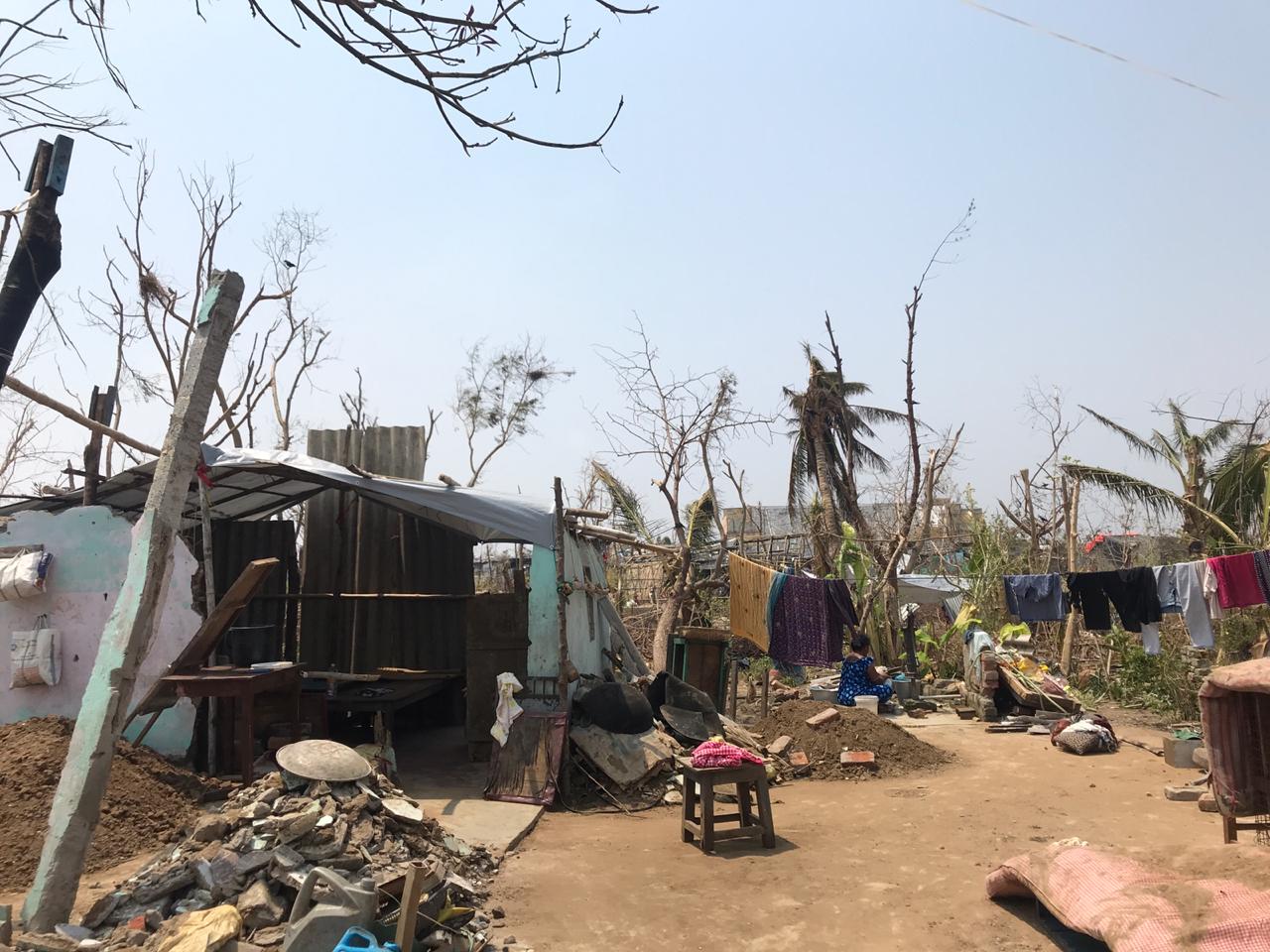
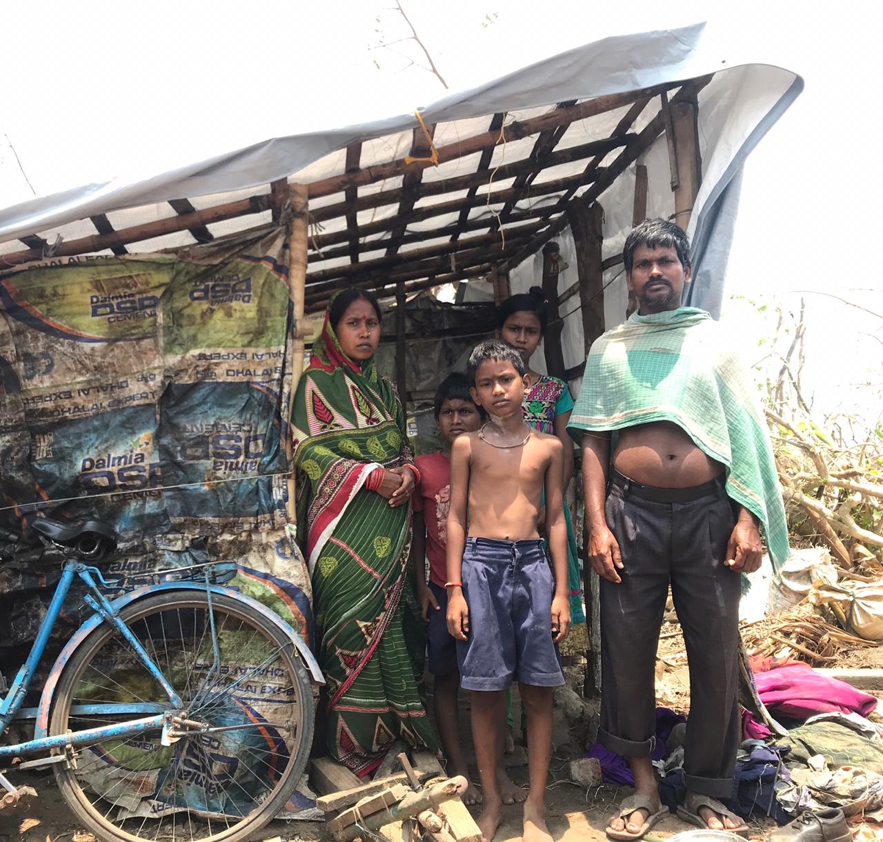
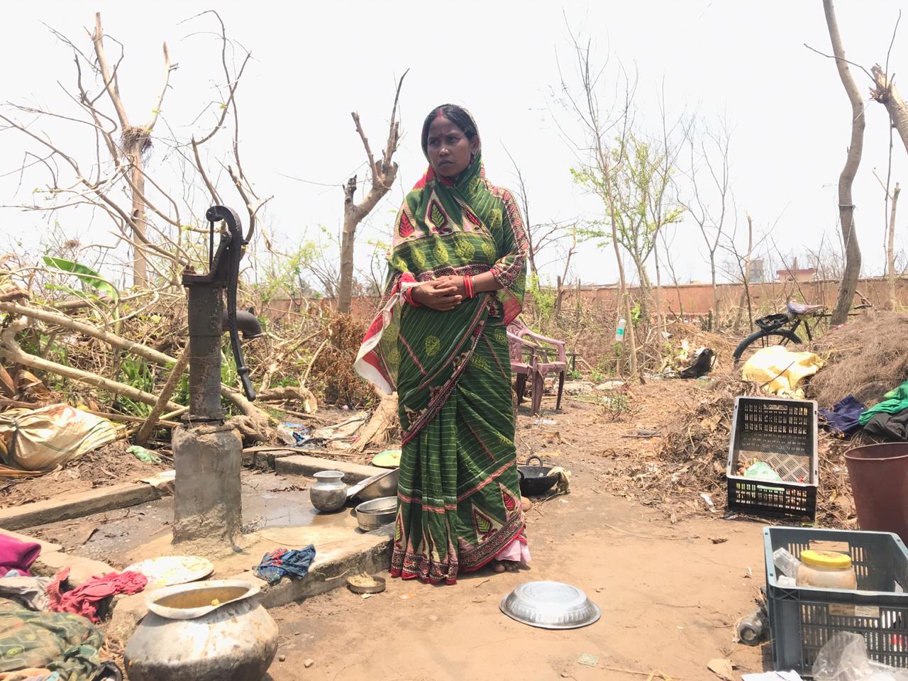
Last May, Odisha was hit by Cyclone Fani causing extensive damages to the infrastructure. Timely evacuation saved several lives. Photo: Nidhi Jamwal
Super cyclone Amphan has now weakened to an extremely severe cyclonic storm and is moving north-northeastwards in the Bay of Bengal, expected to cross West Bengal-Bangladesh coasts between Digha (West Bengal) and Hatiya Islands (Bangladesh) tomorrow, May 20, afternoon to evening hours. The “cyclone has extensive damaging potential. It will cause extensive large scale damage,” including uprooting of communication and power poles, damage to standing crops and roads, as warned by the India Meteorological Department (IMD).
The met department has already issued a heavy rainfall warning in Odisha, West Bengal, Sikkim, Assam and Meghalaya. During the landfall tomorrow, the gale wind speed is expected to be 155 to 165 kilometres per hour (kmph), gusting to 185 kmph, along and off east Medinipur and north & south 24 Parganas districts, and 110-120 kmph, gusting to 130 kmph, over Kolkata, Hoogli, Howrah and West Medinipur districts of West Bengal.
Fishing activities have been suspended. A storm surge of about four to five metres “is likely to inundate low lying areas of south & north 24 Parganas and about 3-4 meters over the low lying areas of East Medinipur District of West Bengal during the time of landfall”. To provide help in West Bengal, 19 teams of the National Disaster Response Force have been deployed, and four teams kept as standbys. In Odisha, 13 teams are deployed and 17 in standby.
It is after two decades that the Bay of Bengal has recorded a super cyclone. The last such super cyclone was in October 1999 when Odisha was hit by it, killing over 10,000 people. Based on the sustained wind speeds, the IMD categorises cyclones as cyclonic storm, severe cyclonic storm, very severe cyclonic storm, extremely severe cyclonic storm, and super cyclone.
But what makes cyclone Amphan stand out is the fact it intensified from category-1 cyclone to category 5 within 18 hours, thus, evolving as the strongest cyclone ever recorded in the Bay of Bengal.
“Our research shows that high ocean temperatures are conducive for rapid intensification of cyclones in the north Indian Ocean. In the current case, Bay of Bengal has been particularly warm, which may have had some role in the rapid intensification from a depression to a cyclone and then to a super cyclone in a very short time,” said Roxy Mathew Koll, climate scientist with Indian Institute of Tropical Meteorology, Pune.
For example, some of the INCOIS/NIOT moored buoys in the Bay of Bengal registered maximum surface temperatures of 32-34°C consecutively, for the first two weeks of May. “These are record temperatures driven by climate change— we have never seen such high values until now. These high temperatures can super charge a cyclone since tropical cyclones primarily draw their energy from evaporation at the ocean surface,” he added.
The Bay of Bengal has never before recorded such high values of sea surface temperature. And it is a known fact that heating of the oceans is contributing towards the intensification of tropical cyclones.
“Formation of cyclone needs many ingredients. A warmer ocean — anything more than 27.5 degree C, reduced wind shear, an area for convergence for making air flow to rotate anti-clockwise to form a low pressure area, strong humidity level, etc,” M Rajeevan, secretary, Union ministry of earth sciences told Gaon Connection. “Only sea surface temperatures are not sufficient, both dynamical and thermo-dynamical factors will determine whether a cyclone will form or not,” he added.
But, according to him, for intensification of a cyclone, ocean heat content is more important, not only temperatures at the ocean surface. “Both sea surface temperatures and ocean heat content are more this time. It could be an effect of global warming,” he said.

This rapid intensification was also documented by the IMD during the Ockhi cyclone of 2017 which killed 347 fishers in Tamil Nadu and Kerala. A report by met department had noted the unusual features of Ockhi cyclone: “There was rapid intensification of Ockhi during its genesis stage, as it intensified into a CS [cyclonic storm] at 0830 IST of 30th, after its genesis as a depression at 0830 IST of 29th (within 24 hrs).” The report went on to mention that the cyclone “intensified from deep depression into a cyclonic storm over Comorin area within six hours.” This intensification normally takes two days.
“Global warming is leading to an increase in the heat content of the upper oceans around the globe,” said V Vinoj, assistant professor, School of Earth, Ocean and Climate Sciences at the Indian Institute of Technology Bhubaneswar, Odisha. “This is also true for the oceanic regions around the Indian region. This is one of the causes of the increasing number of cyclonic activities in our region during pre-monsoon times,” he added.

According to Sridhar Balasubramanian, associate professor with the department of mechanical engineering, Indian Institute of Technology Bombay, apart from the high sea surface temperature, atmospheric waves gave the necessary convective push for the formation of the cyclone Amphan.
These atmospheric waves include convectively-coupled Kelvin wave (CCKW) and the Madden-Julian Oscillation (MJO). “The sea-surface temperature in the Bay was very high till May 11, after which it started dropping slowly. But, the cyclone Amphan started forming only from May 16,” said Balasubramanian.
This is because by then the MJO had moved into our Indian Ocean basin and so did the convectively-coupled Kelvin wave. “Together, the high sea-surface temperature and these atmospheric waves gave the necessary push for the formation and intensification of the Cyclone Amphan,” he added. As these waves have now decoupled from the system and moved out of our basin, the cyclone has started to weaken, he informed.
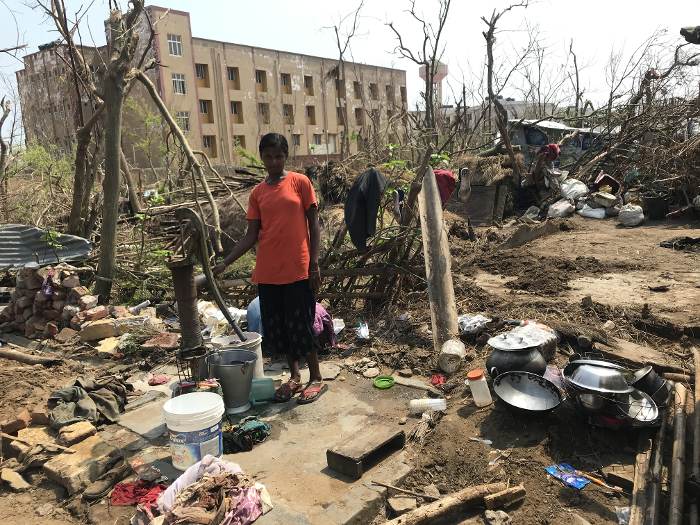
From a Super Cyclone, Amphan has already weakened to an extremely severe cyclonic storm. Will it landfall as an extremely severe cyclonic storm, or will it further weaken to a very severe cyclonic storm? Either way, damages are going to be very high and timely evacuation of people living in low-lying areas and providing them safe shelter can save many lives. Such evacuation had saved several lives last May when Cyclone Fani hit Puri in Odisha.
But, amid the COVID-19 pandemic, there is another challenge. “Cyclone Amphan, which is about to hit Bangladesh, is going to compound the COVID19 pandemic as well as lockdown and social distancing measures. While Bangladesh has an enviable system of cyclone warning and cyclone shelters, it will be almost impossible to practice social distancing in those shelters,” said Saleemul Huq, director, International Centre for Climate Change and Development, Bangladesh.