

‘We’re ready to die but won’t let an embankment be built on the Bagmati’
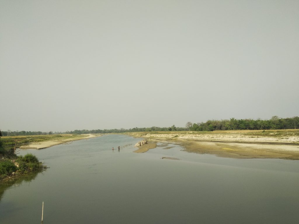
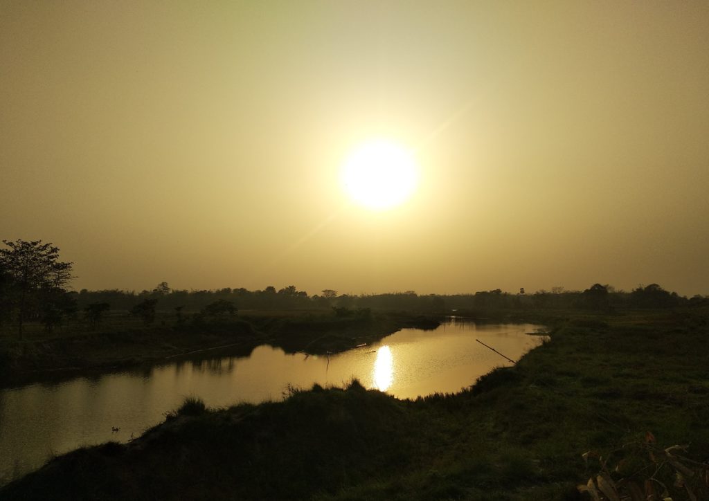
Only a short stretch of the Bagmati river in Bihar flows free. Farmers in Muzaffarpur are up in arms against the state government’s proposal to embank that portion too. They fear this will lead to worse floods and increase sand deposits on their farmlands.


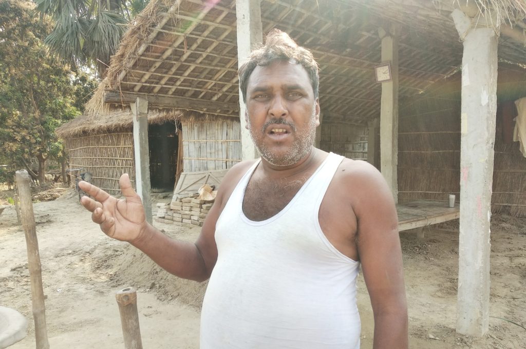
Farmers in Mandal’s village of Muzaffarpur are up in arms against the state government’s proposal to embank a portion of the Bagmati river. All pics: Umesh Kumar Ray/GC
Muzaffarpur, Bihar
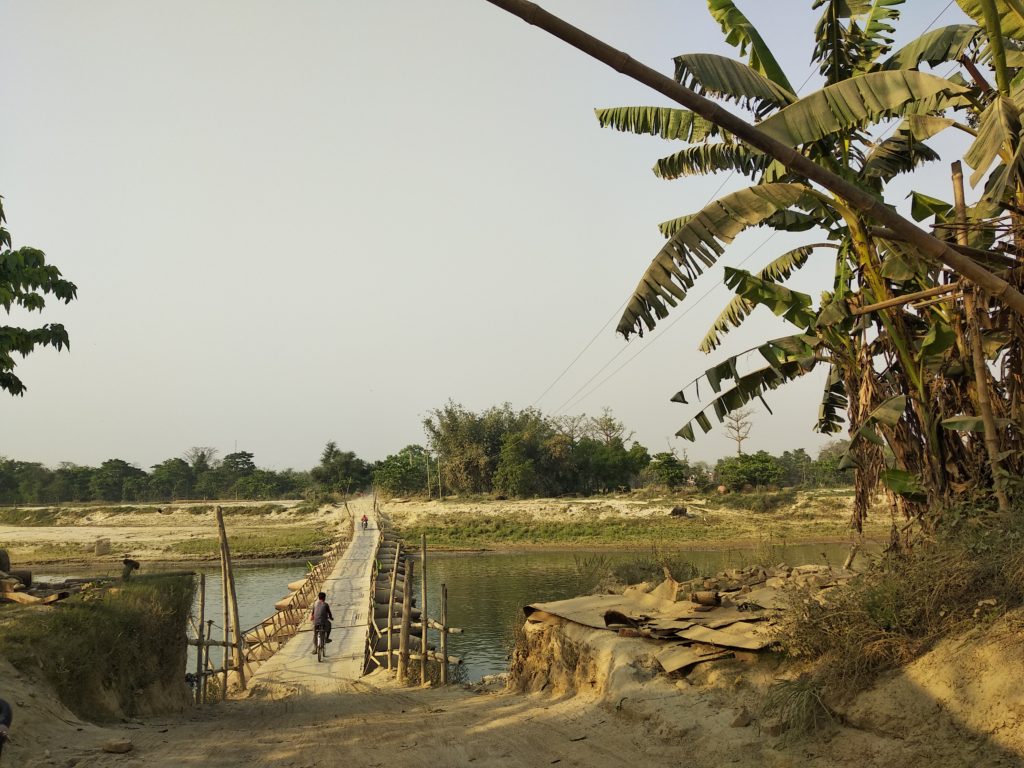
Lallan Mandal has built a house just beside the bank of Bagmati River in Muzaffarpur district of Bihar. This is the third house he’s built in as many years, after two others were destroyed by erosion. He has lost five acres (2.03 hectares) of land too. Despite this, he does not want any embankment (locally called bandh) on the Bagmati river.
“Embankments will destroy us. They eat into our houses, fields, hospitals and schools. We can bear the loss caused by land erosion, but cannot face the destruction the embankment will bring,” Mandal, who lives in Gosaitola village told Gaon Connection.
Farmers in Mandal’s village and the neighbouring villages are up in arms against the state government’s proposal to embank a portion of the Bagmati river. They fear the embankments will increase the intensity of floods and leave huge silt deposits on their field, rendering the land infertile.
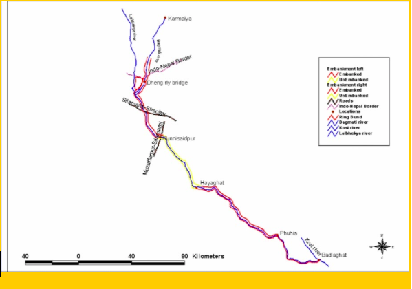
The Bihar government has approved construction of a new embankment and elevation of an old embankment under Phase III (b) and Phase V (a) of the Bagmati flood management plan. Under this, the government will construct a 56-kilometre-long embankment from Benibad (Muzaffarpur) to Hayaghat (Darbhanga) on the left bank of the Bagmati.
On the right bank, another 56-km-long embankment will be constructed from Benibad in Muzaffarpur district to Sormar Hat in Darbhanga district. This is the only stretch of the about 586-kilometre long Bagmati river in Bihar, a tributary of River Ganges, that remains ‘free’ and has not been restricted by constructing embankments (see map).
Source: Central Water Commission
Also Read: It is time we stop demonising riverine floods during monsoon as a calamity. Here is why
Villagers want this stretch of the river to remain ‘free’. Flood water now recedes within days, but if there’s an embankment, the fields will remain waterlogged for three or four months, and we would have to abandon a cropping season, farmers fear.
Hundreds of farmers whose villages are near the Bagmati have been protesting the construction of embankments since 2012. In the last five to six decades, embankments have been constructed from the Indo-Nepal border to Runni Saidpur in Sitamarhi district and from Badlaghat in Khagaria to Hayaghat in Darbhanga district.
Embankments and floods
Bihar is India’s most flood-prone state; 28 out of its 38 districts are flood-prone, according to the Water Resource Department of the state government.
The plains of Bihar, adjoining Nepal, are drained by a number of rivers that have their catchments in the Himalayas of Nepal – including the Koshi, Gandak, Bagmati, Kamla Balan, and Mahananda. They carry high levels of discharge and sediment load, which are deposited on the plains of Bihar.
Also Read: Bihar floods: An annual blame game between India and Nepal
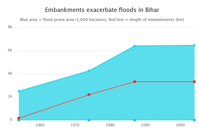
The Bihar government has been promoting embankments as a ‘solution’ to the annual flooding in the state. An embankment is an earthen wall built with mud and stones usually 10-12 metres wide at the base and 5 metres wide at the top. Embankments are constructed to save people and their property from floods. If official data is to be believed, embankments seem to have failed to address the floods ‘problem’ in the state.
Till 1954, only 154 kilometres of embankments were built on rivers in Bihar. By 1988 — in 34 years — this length reached 3,454 km. Till March 2017, the total length of embankments in Bihar was 3,759.94 km. From 2005 to 2013, around 88.97 km of embankments were constructed on the Bagmati alone, according to the Bihar water resource department.
Also Read: Bihar flood situation worsens as embankments of the Gandak river breach, about a million affected
However, with this, the flood-prone area grew every passing year. In 1954, an area of 2.5 million hectares in Bihar was flood prone. This increased to 6.46 million hectares in 1988. The same trend has continued (see graph).
120 villages against embanking Bagmati
It is not that the Bagmati is always kind to farmers — many farmers have lost their land and homes to the unpredictable river, but they are still grateful, for it deposits silt on the other side, which they use for cultivation.
Since 2012, farmers have been protesting against embanking the Bagmati. The same year, an organisation — Chaasbaas Jeevan Bachao Bagmati Sangharsh Morcha — that includes social workers and representatives of 120 villages that will be affected by the embankment, was formed to strengthen the movement against the embankment.
The Bagmati is embanked from two sides — the Darbhanga side and the Indo-Nepal side. The protest is over the middle portion that is as yet-unembanked. On both sides, the right bank is embanked for 201.8 km and 127.5 km on the left bank.
In 2007, the Bagmati Flood Management Scheme was formulated to construct an embankment on the remaining part of the Bagmati. This was accepted in the meeting of the advisory committee of the Ministry of Water Resources and Irrigation. Under this scheme, an embankment was to be constructed in phases.
But, protests by local villagers did not let the project take off. “We are ready to die by the government’s bullet, but not in flood waters after the embankment is built. Our life is farming, and the embankment will ruin it. We won’t allow it to be built,” Thakur Devendra Kumar, president of the Bagmati Sangharsh Morcha, told Gaon Connection.
“Due to the opposition of the villagers, the government stopped further work, but started embankment work from the other side in 2017. When we demonstrated again, the government set up a review committee,” Anil Prakash, a social activist associated with the Ganga Mukti Movement, told Gaon Connection.
Review committee
The eight-member review committee was constituted on April 27, 2017. The committee included river experts, social workers and engineers. The tenure of the review committee was one month, but no meeting was held till May 27, 2017.
Anjani Kumar Singh, technical advisor of the water resource department, Bihar, confirmed that only one meeting of the review committee had been held in the past three-and-half years. On May 14 last year, the tenure of the committee was extended till December 31, 2020.
Also Read: Floods 2020: The need for critical engagement with floods in India
According to Singh, only those who reside near the embankment and have taken compensation money are protesting. “Most of the area has an embankment, we can’t leave a small area out,” he said, adding that “those who are living in the outer periphery of the embankment will benefit”.
However, sector experts differ. “Construction of embankments for flood control is harming people instead of benefiting them. After evaluating what has been built so far, the government should tell what people gained. If there’s no gain, construction of embankments should stop,” Dinesh Mishra, a member of the review committee, said. He is also the convenor of Barh Mukti Abhiyan, a non-profit working on floods in Bihar.
“It is pretty clear from the attitude of the government that it wants to build a dam at any cost. The review committee has been set up only to pacify the protesting villagers,” said Anil Prakash, member of the review committee.
Why are people against the embankment
The local people’s protest is due to the suffering of the villagers who have been facing the brunt of the embankment since it was constructed.
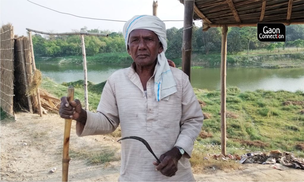
Ten years ago, an embankment was built in Basghatta village. The flood character of the village has since changed. “The embankment has become a noose for us,” 75-year-old Dhaneshwar Das of Basghatta village, about 20 km from Gosaintola, told Gaon Connection. “Flood waters lay the paddy crop waste. The yield has also reduced significantly.”
Sixty three-year-old Mahadev Das of Basghatta has also paid a steep price for the embankment. “I have about twenty acres [8.09 hectares] of land. After the construction of the bandh in 2008-2009, half my field has been ruined. A lot of sand and water stagnates for four to five months,” he told Gaon Connection.
“My field, which once used to give quintals of rice is now not even giving me enough rice to use for worship,” Mahadev rued.
Experts warn against further embanking the Bagmati river. “Due to the huge amount of sediments, the Bagmati changes its course very quickly. By constructing embankments, you are forcing the river to change its route,” Rajiv Sinha, professor at the department of earth sciences in Indian Institute of Technology, Kanpur, told Gaon Connection.
Meanwhile, Dhaneshwar is standing guard with a sickle and laathi in his hand, a determined look on his face. He wants the Bagmati to flow free.
Also Read: Is North Bihar prepared for the overlapping challenge of COVID-19 and the annual floods?