

The west coast of India braces for Cyclone Nisarga; the east coast is still recovering from Super Cyclone Amphan
Both pre-monsoon and post-monsoon cyclonic activities are on the rise in the Arabian Sea. Climate scientists blame this on the rapid warming of the ocean

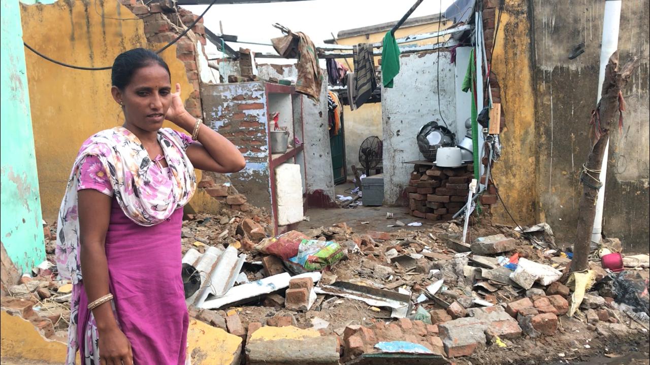
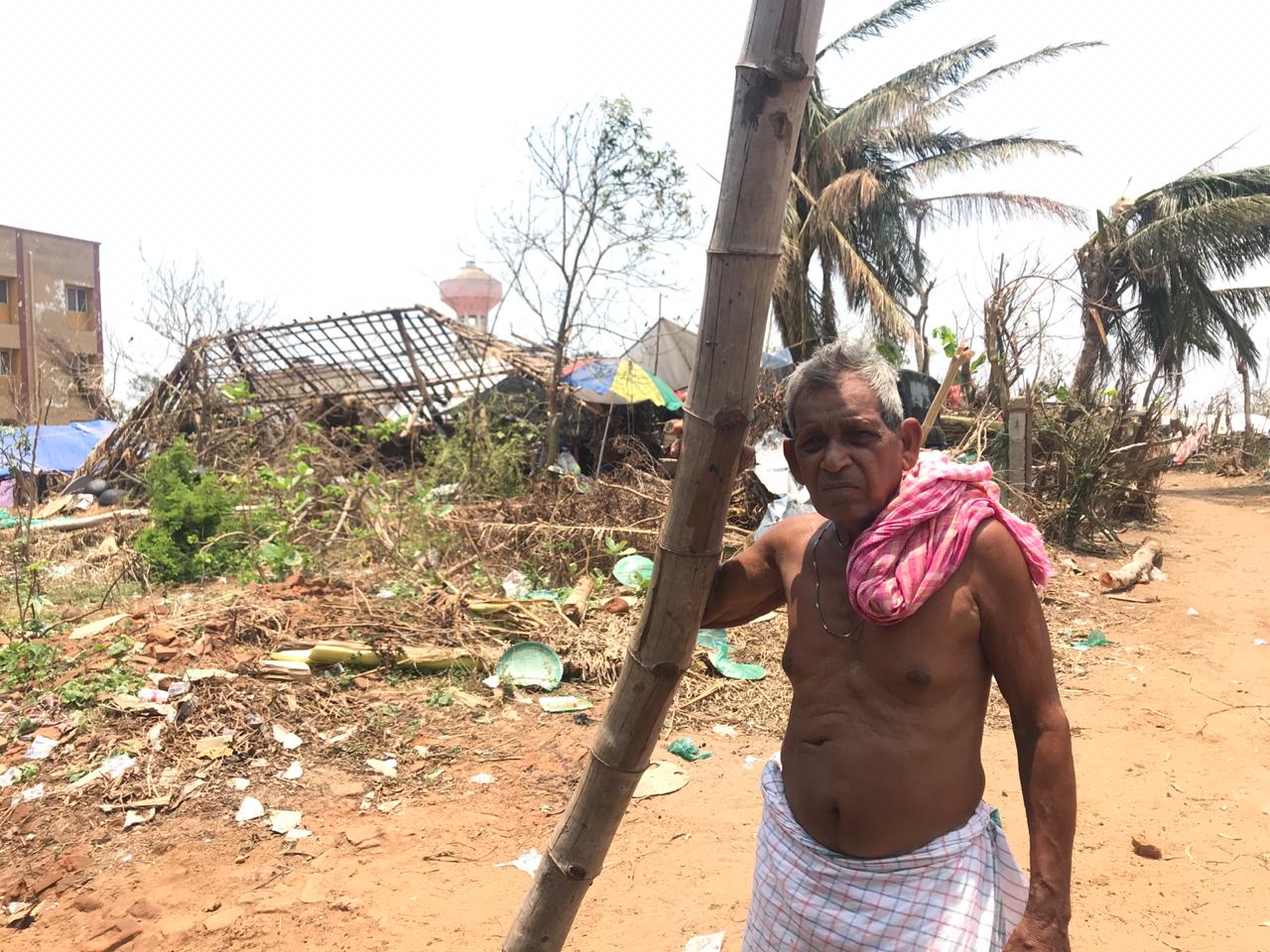
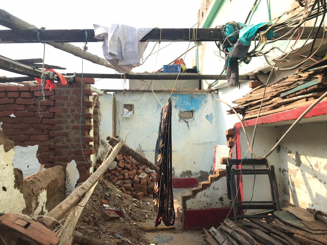
Post cyclone Fani, this was a common sight across Puri where high-speed winds of Fani blew away everything that came into its way. Photo: Nidhi Jamwal
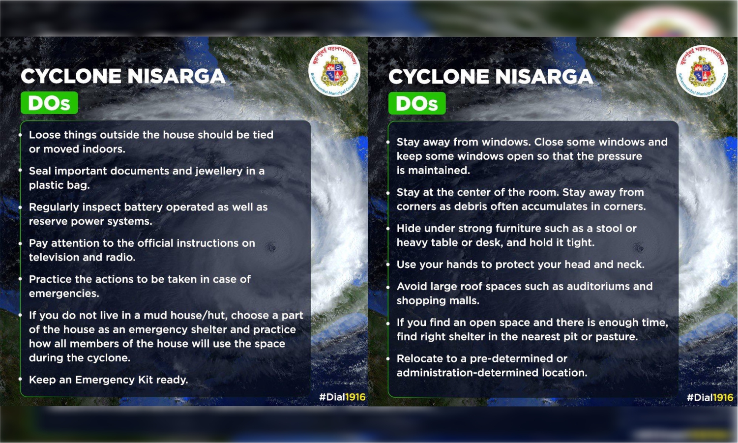
The timing of a cyclonic storm — Cyclone Nisarga — hitting the coast of Maharashtra could not have been worse. The state is facing a spike in the novel coronavirus (COVID-19) cases with the positive cases already crossed 70,000. Yesterday, June 1, the state recorded 76 deaths of which 60 were from the Mumbai Metropolitan Region alone.
Amid this pandemic, the state authorities are now evacuating people from low-lying areas in the coastal districts of Raigad, Palghar and Mumbai, as Cyclone Nisarga is expected to make landfall tomorrow, June 3 afternoon, as a ‘severe cyclonic storm’ near Alibag in Raigad district. Both the coastal parts of North Maharashtra and South Gujarat have been put on a high alert.
Cyclone Nisarga will be the first-ever cyclone in recorded history to hit the Maharashtra coast in the month of June. It is expected to hit with a maximum sustained wind speed of 100-110 kilometres per hour (kmph) gusting to 120 kmph, as mentioned in the bulletin of the India Meteorological Department (IMD).
The IMD has also warned of extremely heavy rainfall — more than 200 millimetre (mm) in 24 hours — at isolated places over north Konkan (Mumbai, Palghar, Thane, Raigad districts) and north Madhya Maharashtra. Further, at the time of landfall, a storm surge of about 1-2 meters height above astronomical tide is very likely to inundate low-lying areas of Mumbai, Thane and Raigad districts up to 1 to 1.5 km. In Ratnagiri district, 0.5-1-meter height above the astronomical tide is likely to inundate the low-lying areas.
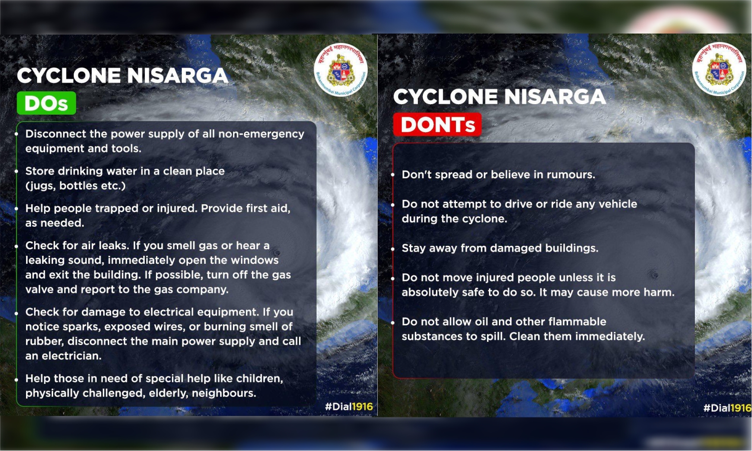
The cyclonic storm is expected to cause damages to thatched houses, power and communication lines, roads, embankments and salt pans and flatten the coastal crops. Fishing operations have been suspended.
“The unique thing about Cyclone Nisarga is that there is very little time between the formation as the cyclone and its landfall — less than 24 hours. Usually, cyclone systems in the Bay of Bengal form early and there is a good lead time for zeroing in on the landfall location by models,” said Sridhar Balasubramanian, associate professor with the department of mechanical engineering, Indian Institute of Technology Bombay.
Warm oceans fuelling tropical cyclones
Among other factors, rising sea surface temperatures is being attributed to an increase in cyclonic activities. “In case of both the recent cyclones — Amphan and now Nisarga, the anomalously warm ocean temperatures are proving to give cyclones a major boost,” said Roxy Mathew Koll, a climate scientist with the Indian Institute of Tropical Meteorology, Pune, and Lead Author, IPCC Oceans and Cryosphere.
“While temperatures in the Bay of Bengal were between 30 and 33°C prior to Cyclone Amphan, surface temperatures over the Arabian Sea recorded 30-32°C prior to the depression, which is now evolving as Cyclone Nisarga. Such high temperatures aid rapid intensification of these cyclonic systems, which many weather models fail to capture,” he added.
According to Balasubramanian, sea surface temperature is one of the factors, but not the sole one; the Indian Ocean is known for its high sea surface temperature. “Along with the high sea surface temperature, we have all the other dynamics coming together, like strong MJO [Madden-Julian Oscillation] in phase 1, Rossby wave activity, weak Kelvin wave and most importantly moisture drag from the monsoon currents and Somali Jet.”
Increased pre-and post-monsoon cyclones in the Arabian Sea
Scientists have observed an increasing trend of the post-monsoon tropical cyclones over the Arabian Sea. However, in recent years, there seems a detectable increase in the cyclonic trends in pre-monsoon season as well.
“During recent years, we have seen a surge in the Arabian Sea cyclones occurring close to the monsoon onset, but we are yet to understand if there is a climate change element to it. Regardless, the IPCC [The Intergovernmental Panel on Climate Change] reports indicate an increase in the Arabian Sea cyclones during the pre-and post-monsoon seasons as a response to the rapid ocean warming trends,” said Koll.
Last year, in 2019, the Arabian Sea recorded highest-ever cyclonic storms — seven (based on data between 1891 and 2018). The last time such a high number of cyclones were formed in the Arabian Sea was in 1998 with six such storms.
An assessment of by IMD showed 11 cyclonic disturbances (CDs) developed over the north Indian Ocean, including four over the Bay of Bengal and seven over the Arabian Sea in 2019. “Thus, the Arabian Sea has been more active during 2019 with the formation of seven CDs against the normal of 1.7 CDs per year. Similarly, four cyclones have developed over the Arabian Sea against the normal of one per year,” the weather agency noted.
This is not all. The year 2019 also witnessed the development of more intense cyclones over the Arabian Sea. Cyclone Vayu (June 2019) and Hikka (September 2019) were very severe cyclonic storms; Cyclone Maha (November 2019) was an extremely severe cyclone storm; and super cyclonic storm Kyarr (October 2019).
As per the IPCC scientists, tropical cyclones are becoming intense due to the ocean heatwaves and warming up of oceans. “The recent IPCC’s special report on Ocean and Cryosphere in a changing climate made very important revelations about the changing characteristics of the sea,” said Anjal Prakash, research director and adjunct associate professor, Bharti Institute of Public Policy, Indian School of Business, Mohali. “The impact of the warming of the ocean means that there would be an increase in the incidences of tropical cyclone winds and rainfall, and increases in extreme waves, combined with a relative sea-level rise, exacerbate extreme sea- level events and coastal hazards,” he added.
Mumbai, a high-risk city
Mumbai, which is on a high alert due to Cyclone Nisarga, has already been identified as one of the coastal cities highly vulnerable to sea-level rise, tropical cyclones and extreme weather events. A 2017 study by a research scholar from Jawaharlal Nehru University titled ‘Impacts of predicted sea-level rise on land use/land cover categories of coastal areas of Mumbai megacity’ warned that Mumbai could lose 25.32 sq km — roughly 1,700 Wankhede stadiums — of its urban sprawl to coastal inundation caused due to one metre sea-level rise over the next 100 years.
Cyclone Nisarga is expected to flood Mumbai’s low-lying areas. Even during monsoon rainfall, the city regularly faces flooding, as little attention has been paid towards its natural water systems and drainage of run-off. Its rivers and wetlands have been encroached upon, whereas mangroves have been chopped off for various development projects.
“The Mithi River, which is the major drainage point in the north, has been reduced to an open drain due to severe encroachments and discharge of industrial effluents into the river,” said Prakash. “Occurrence of cyclones are becoming a new normal and therefore unprecedented moves are needed in times which are increasingly uncertain,” he added.
“Despite this [sea level rise, cyclones and recurring flooding], there is little change in thinking among planners and policymakers – in fact, the extent of denial is quite breathtaking,” Hussain Indorewala told Gaon Connection. He teaches planning theory, housing and humanities at the Kamla Raheja Vidyanidhi Institute of Architecture and Environmental Studies, Mumbai.
Rather than helping the city adapt to climate change, the state administration is floating expensive [questionable] infrastructure projects. “For example, the technical studies for the Mumbai Coastal Road project systematically underestimate sea-level rise, with an assumption of 1.27mm per year. Current estimates of sea- level rise according to the Australian government range from 0.5 meters to over 2 meters by 2100. Scenarios of one-meter rise or more by 2100 cannot be ruled out for planning adaptation measures,” he added.
Managing a cyclone amid the COVID-19 pandemic is going to be a big challenge. “Most of the poor in Mumbai live in slums which are, sometimes also the low-lying areas with very poor drainage and sanitation facilities. The combination of the pandemic and the disaster could be dangerous especially for people living in these locations,” said Prakash.
“This storm — and the ones that are likely to come in the coming years — ought to wake up the city’s planners to the city’s extreme vulnerability to climate events, and put some serious thought and behind what Mumbai needs, what it can actually afford and what it must urgently prioritise,” said Indorewala.